
West Springfield Street Search Path
Fairfax County keeps the practical address trail in separate systems. For a West Springfield street, first normalize the delivery address, then find the tax map number in iCare. Confirm the parcel on Jade before opening any land record. The Circuit Court instrument, rather than an assessment card or a map, is the record that states the recorded legal description. A directory or voter record can be a dated supporting source, but neither proves every person who was physically present at an address.
Keep a small parcel ledger as you work. Record the exact address searched, map number, situs address, mailing address, subdivision or lot language, retrieval date, and instrument or book-and-page reference. That prevents two similarly named roads, units, and renamed community labels from being combined into one result.
- Enter the known address in Fairfax iCare's address search. Save the map number and the situs address returned with the result.
- Use the map number, address, or subdivision in Jade to confirm the parcel and see the county layers associated with it.
- Use an owner field only as an assessment-record clue. Compare the map number and legal description before connecting any name to that parcel.
- Find the purchase instrument through the Fairfax Circuit land-records route, then read its grantor, grantee, and prior-conveyance reference.
- For a dated household clue, consult Virginia Room volumes and match the printed street form to the parcel history.
Note: A current assessment result, a deed date, and a printed directory entry describe different times and should be logged separately.
West Springfield Street Directory in iCare
The public iCare landing page exposes Address, Map Number, and Map Search choices. It does not present a general owner-name search mode. For a whole-address pass, leave Number blank, enter the street name, omit the suffix if a narrow search misses results, choose a larger results-per-page setting, and check every results page. The map-number search accepts up to 30 characters and supports beginning or ending wildcards. A withheld owner field is a stated portal limitation, not evidence that a parcel lacks an owner.
iCare distinguishes the property, or situs, address from the mailing address used for tax correspondence. A sale date, assessed value, physical characteristics, and an owner field can be useful context. They are assessment data, not a title opinion or a statement of current occupancy. Fairfax says characteristics, ownership, sale dates, and prices are updated twice weekly, while assessed values apply as of January 1 for the years shown.
| iCare field | Input or choice | Street-search use |
|---|---|---|
| Number | Optional text, up to 5 characters | Leave blank for a broader street result. |
| Unit# | Optional text, up to 4 characters | Separate a unit query from a street-only query. |
| Street | Optional text, up to 20 characters, wildcard supported | Use the name without a suffix when a direct form is too narrow. |
| Suffix | Optional dropdown | Choose the displayed road type after checking the broad result. |
| Sort and page size | Map number, owner, property address, or last sale; 15 to 50 results | Sort consistently and preserve every returned map number. |
See the iCare address-search screen before entering a query.
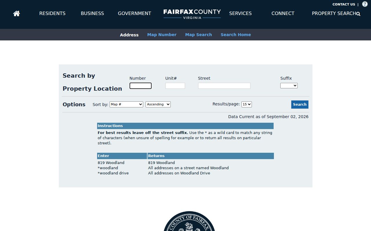
The number, unit, street, suffix, sorting, and results controls support a documented by-address search instead of an unsupported name-only assumption.
Map a West Springfield Street
Jade supplies the spatial half of an address search. Its Parcel Search uses PIN autocomplete. Address Search accepts house number, street name, and street type; Street Intersection Search takes two road names; Subdivision Search can bridge an older lot description to a modern parcel. After selecting a parcel, use the layer controls for parcels, zoning, elevation, districts, transportation, or historic aerials. Fairfax reports more than 170 available layers, with aerial imagery dating to 1937.
Click or rectangle selection, buffering, and selected-attribute export are useful for a research note. They are not boundary proof. A buffer may identify nearby parcel numbers, but a recorded deed and, where needed, a survey resolve a legal boundary. Record the visible layer and date because districts and map layers can change independently of a deed.
Visit the Fairfax Maps and Jade page to start the map search.
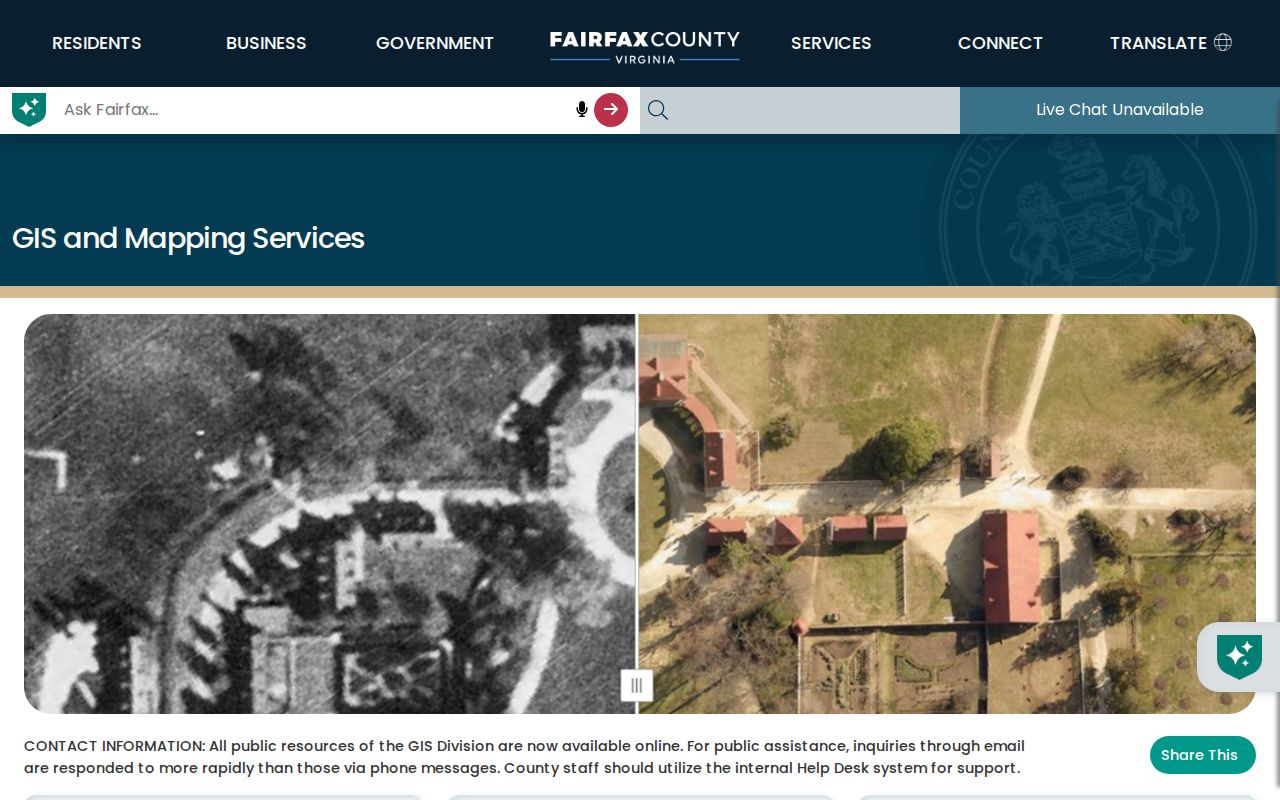
Jade is most useful as a parcel and layer check between the iCare map number and the recorded instrument.
West Springfield Deeds by Address
An address trail becomes more reliable when it is tied to a recorded instrument. Fairfax land-record images are available from 1742 to the present, but the index route changes by era. CPAN index data is generally available from 1980 forward, while book-image indexes cover 1742 through 1979. Older books and research support are available through the Historic Records Center. A grantee is the buyer in an instrument, and a grantor is the seller. Start with the current grantee deed, then use the stated prior conveyance to work backward.
Older deeds may name a subdivision lot, section, acreage, plat, or adjacent owner instead of a modern street number. A release, deed of trust, estate transfer, or boundary adjustment can resemble a transfer without establishing a new owner. Keep its document type in the ledger rather than calling every instrument a sale. The research room is open Monday through Friday, 8:00 a.m. to 4:30 p.m.; CPAN provides remote subscriber access, while courthouse terminals support public research.
The Fairfax land-record research page explains the research-room, CPAN, and digitization routes.
Bring an instrument number or deed book and page when requesting a copy, since Fairfax uses those references to retrieve the record.
West Springfield Address Records
No single West Springfield street directory contains every address fact. The systems below are useful when their scope is kept distinct. Current parcel discovery begins online, while older index gaps call for the research room, Historic Records Center, Virginia Room, or Library of Virginia holdings. County staff can explain access and indexing, but they do not perform a person's research.
| Address record | Query key | What it can show | Access path |
|---|---|---|---|
| iCare assessment card | Address, map number, map | Public owner field when available, situs and mailing data, values, characteristics, sales | Free web search |
| Jade or Digital Map Viewer | Address, PIN, street, intersection, subdivision | Parcels, selected attributes, districts, aerials, map products | Free map and export tools |
| Deeds and plats | Grantor, grantee, instrument, book and page | Recorded title chain, legal description, plat, and boundary clues | CPAN, research room, HRC, copy request |
| PLUS and LDIH | Address, parcel, record number, project or date | Permit, inspection, site, zoning, and code-event records | Public portals; legacy gaps may need office help |
| Directory and newspaper runs | Street, name, year, subject, date | Dated printed address, phone, notices, and community context | Virginia Room and archival collections |
| Voter record routes | Identity and locality, or regulated request filters | Limited registration and precinct information | Citizen Portal, registrar, state request process |
A parcel's map number is the strongest bridge between the assessment card, map, permit record, and deed. A postal ZIP or neighborhood label is not a parcel identifier.
PLUS Records for West Springfield Streets
Fairfax PLUS adds address-keyed building, site, planning, environmental, zoning, enforcement, and inspection material to the street record. Search its Building module by site address, parcel, record number, or dates, then inspect Record Info, Inspections, and related records. For older material, LDIH and its SRV geographic search are the legacy route. PLUS replaced FIDO, PAWS, and ProjectDox on October 31, 2022, so a blank modern result may need a legacy check.
An applicant, contractor, or person named in a permit has a role in that record. It does not establish who occupied the property. Use the permit number and date as evidence of an address event, then compare it with a parcel and deed reference. Permit questions can go to Fairfax Land Development at 703-222-0801; older gaps may require office assistance or a VFOIA request to the right custodian.
West Springfield Street Labels
West Springfield is a Census-Designated Place and an unincorporated Fairfax County community, not an incorporated city with a separate municipal grid. The postal name Springfield, the West Springfield community label, the Census boundary, and subdivision names can overlap without meaning the same thing. Preserve each one as shown by its source. County GIS tools help normalize an address, USPS confirms a delivery string, and the deed controls the parcel description.
- Parcel
- The county's mapped property unit.
- Situs address
- The physical property address used in assessment records.
- Plat
- A recorded map that can show lots and subdivision layout.
- Criss-cross directory
- An address-first directory section that points back to a listed name.
When a historical volume seems to use a different address, test the lot, section, subdivision, map number, and adjacent-owner references. The Fairfax historic-site guidance notes that older deeds may omit a street address. No official source located a West Springfield-wide renumbering or annexation event, so no date should be assumed.
West Springfield Street History
For the historical layer of a West Springfield street directory, use a dated local volume rather than a current list. The Virginia Room holds West Springfield Civic Association directories for 1964 to 1971, 1972 to 1976, 1978 to 1980, 1988 to 1990, 1995, 1997, and 1999 to 2001. Westmore telephone directories and street maps cover 1961, 1975, 1981, 1989, and 1991. Springfield/Lorton Community Directory volumes provide a broader address-and-name comparison from 1981 through 1995 in listed runs.
Those volumes are snapshots, not a current roster. The civic association's current directory is private and limited to members or new residents who agree to be listed. A street-first search should note the printed year, address form, and source title, then compare adjacent available volumes. The historical collections themselves are described in the West Springfield city directory holdings.
For a notice or event, the Fairfax Historical Newspaper Index covers selected years from 1785 to 2000. Its exact-match search uses a keyword between two and 25 characters, with newspaper, date, and index-type controls. It points to an article; it does not prove every detail of an event.
West Springfield Streets and Precincts
Voter geography is a precinct and district question, not a street directory or ZIP question. Virginia's public voter-list fields are limited by Va. Code §24.2-444. The public field set excludes Social Security numbers, full dates of birth, protected-address details, and other protected information. Individual status lookup through the Virginia Citizen Portal requires first name, last name, date of birth, last four Social Security digits, and locality.
For a lawful request, the Fairfax Office of Elections is the local channel, and the Virginia Department of Elections controls the statewide voter-list request process. That form has client type, declared-purpose, locality, district, election, and product choices. VFOIA does not bypass election-law limits. Historical poll books and registration records need a year-specific inquiry to the Library of Virginia, the Historic Records Center, or the registrar.
Note: Registration status is a dated administrative record and cannot confirm every household member or present physical occupancy at a street address.
Limits of West Springfield Street Directory
A street-based result can identify a parcel, a recorded party, a listed telephone subscriber, or a dated directory entry. It cannot safely turn those fragments into a full household list. DTA allows owner-name withholding from online iCare records. Protected voters may use substitute-address protections. Fairfax did not locate utility account or customer data as a public person lookup. A phone listing, civic directory, or permit record can also reflect a limited role rather than residence.
Separate owner, mailing contact, permit participant, directory listing, and physical occupant in the research note. Where sources conflict or an index fails, record the source and date rather than filling the gap with an assumption. Contact the office that keeps the specific record for an access question, a copy request, or a VFOIA request.
Lawful use. West Springfield address records support personal, lawful research and civic or family-history questions. Do not use record details to stalk, harass, intimidate, or harm anyone.